Exploring the world's built environments and seeking sustainable solutions.

Tuesday, July 27, 2010

Sustainable Cities of Northern Europe Tour: Ærø, Denmark


For college students, 5:30 AM is an ungodly hour to wake up for. Yet, we'll make exceptions for special occasions, and our class day trip to the island Ærø was well worth it. Like many of the smaller towns we have visited in Scandinavia during this class, we'd never heard of Ærø before visiting it. We had arrived in Odense, Denmark for a little bit of rest and relaxation, to tour the city’s extensive bike infrastructure and to experience the serene and extensive parks and green spaces. Despite all the amenities of Odense, we felt that Ærø stole the show with its historical quaintness and natural beauty, but also because of its far-reaching success with building power and district heating infrastructure that utilizes the latest in renewable energy technology.


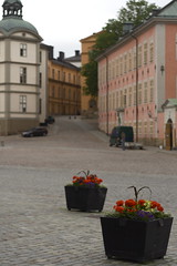
Located in the South of Funen Archipelago, Ærø Island is roughly 30 km and up to 8 km wide. About 6,500-7,000 inhabitants live on the island permanently and about a third of them are 65 years or older. According to the island’s tourist website, they see around 300,000 visitors every year. After an hour-long ferry ride, we arrived at Ærø, where were greeted in the sailboat and yacht filled harbor by the island’s civil planning director. The first sign that this island was serious about environmentally friendly means of transportation were the three Norwegian built electric cars parked near the entrance of the harbor. Apparantly, the island was given a grant by the energy ministry of Denmark to purchase the vehicles and there are plans for more on the way. We were given a tour around the second largest city on the island, Ærøkobing where we learned about the very strict requirements for the buildings on the island. Essentially any renovation that may change the exterior of the structure, from the windows to the front door, must be approved by a committee that attempts to keep the look of each building as it did when it was originally built. Since many of these buildings were built between 1700 and 1900, you can see how this process may be somewhat complex. The result, though, is an absolute fairytale and charming feeling throughout the entire island.

After our walking tour, we were escorted onto a bus waiting to bring us to another side of the island. Along the way we passed through stunning rolling hills and plains of grass, cornfields and strawberry fields. Small cottages and farm houses dotted the countryside. The bus took us to the site of 3 massive wind turbines which provide 65% of the island’s electricity needs throughout most of the year. One of Ærø's energy engineers gave us a brief tour of the turbine. He even took us inside and powered it off by adjusting the pitch of the 30 story tall propellers. What a show! Apparantly, the island is well situated for optimal wind turbine capacity due to the slight level of variation in the island’s height. This pushes the wind upwards and faster over the surface over the island, creating steady breezes in almost every season.

Our last stops on the bus tour took us to two of the three district heating facilities on the island. The first one we visited was a solar water heating plant that provided more than half of one of the city’s hot water and heating needs through very clever means. There were three types of solar heat collectors; one main simple design that was used the most in this facility piped water through narrow tubes and used the ultra violet heat collecting capacity of the color black to heat the water inside to around 80 degrees Celsius. This water was then pumped into a heat exchanger to extract heat from the water, turn it into steam and distribute it throughout the network. Another method used parabolic mirrors angled around a thin tube to produce steam directly from the sun’s rays. While this method is innovative, the island does not see enough direct sunlight for most of the year to be truly cost effective. The final design was similar to the first design except that the entire set-up was enclosed inside a vacuum tube to maximize efficiency (because, ironically, the solar heat collectors work best when they are not super hot).

The final district heating facility we visited used waste wood scraps from the lumber milling industry that they turned into pellets and burned for steam. Another boiler they installed utilized straw grown on the island itself to create steam. For the instances where the demand was too great that the wood boiler and straw boilers couldn’t keep up, they had an oil burning boiler as well. We finished our trip with a visit to the local grocery store for lunch and a stop at the beach before heading back on the ferry to the mainland In all, Ærø was the perfect ending to our stay in Denmark.

-Megan Kirkaldie and Jason Daniel, UC Santa Cruz

-Darwin Moosavi and Debs Schrimmer, UC Davis


Sunday, July 18, 2010

In Malmo, Sweden, we looked at Vastra Hamnen, a relatively new development on the coast, and rated the neighborhood on part of the new LEED Neighborhood Development scale. The slide show can be viewed below.


Mariatorget - Urban Design Qualities Inventory

Mariatorget is a plaza that is situated in Stockholm, Sweden in a busy shopping district near Slussen Station. There are several design elements that make this plaza quite successful in terms of sustainable urban design.


Below are our observations and assessments of this particular plaza:

COMFORT
- Adequate Seating. There is a wide variety of seating choices from lawn space to benches to suit individual or group activities
. People can be found eating food from the local vendors on the lawns, reading a newspaper or novel on the bench, or just conversing with friends by the fountain.
- Shade/Access to Light.
Trees line the entire area to provide shade from the long hours of sunlight during the summer season. There is adequate access to sunlight along the central north-south axis of the plaza as well.
- Sense of Safety
. The plaza is relatively safe due to the narrower, less trafficked streets that surround the east, west and south sides of the plaza. There are barriers implemented that provide protection from vehicles (sidewalks/fences).
- Access to Services/Facilities.
Services such as cafes, pubs, street vendors and restrooms are in relatively close proximity.

URBAN DESIGN APPEAL
- Access to Transportation. Mass transit (bus stops) and bike parking are along the perimeter of the plaza.
- Noise Reduction.
The plaza utilizes the surrounding buildings and lanes to create a wide range of areas (quieter to more social environments).
- Suitable for Users of All Ages.
Children-friendly areas (playgrounds) are located away from heavy automobile traffic for safety reasons. Variety of seating opportunities can accommodate those of all ages.
- Cost-Effectiveness. Little maintenance of public displays and vegetation is required.

- Accommodation for Activities. Grassy lawns can be used for multiple purposes (outdoor play areas, or just for lounging).
- Waste Disposal. Trashcans are strategically placed throughout the plaza for convenience.
- Accessibility.
The plaza does not slope and is handicap accessible. There are no stairs to enter/exit the plaza.
- Connectivity.
Within a short distance, there are other plazas (three blocks away).

WALK-ABILITY
- Wide Central Lane. The plaza design provides for easy access to all areas of the public space. There is a wide central lane to accommodate pedestrian traffic and the occasional bicyclist.
- Open Space.
The plaza is not closed off/gated. Fences are built low enough to allow individuals to enter the plaza from any side, creating multiple pathways.

VISUAL APPEAL
- Use of Axis to Direct Views. There is an axis to draw individuals to the center of the plaza where the f
ountain is the main attraction. This place acts as a central gathering point.
- Public Art Displays. Outdoor sculptures are placed near seating areas. Seating is arranged for varying views of the plaza (trees, fountain, or surrounding street views).
- Well-Maintained Landscape. Vegetation as well as o
utdoor sculptures/displays provide a scenic view throughout all areas of the plaza.
- Use of Water. The element of water in the fountain is ca
lming/soothing.
- Cleanliness. Waste disposal bins are placed strategically near local vendors or near seating areas to reduce litter, which creates a sense of cleanliness.

CHANGES TO MARIATORGET
- Moveable Chairs. The use of moveable chairs can create more group interaction in the plaza. Current seating (benches) may not be able to accommodate large groups.
- Recycling Bins in the Area. Along with waste bins, recycling bins can create a more sustainable environment.

APPLICABILITY TO THE UNITED STATES
Mariatorget is a prime example of a successful plaza th
at has been integrated into the urban landscape. It is a well designed plaza that offers a transitional space from the busy city life to a quieter, calmer environment. A common mistake in the United States is that plazas are not in close proximity to other green spaces, or local transit options. Many plazas are also built much too large. Consequently, the space becomes underutilized due to its expansiveness. Therefore, the use and features of these smaller plazas in connection to other smaller plazas can be applicable.

Posted by: Melody Wu, Bernadette Rosero Dugtong and Matt Ichinose

Saturday, July 17, 2010

The Streets of Copenhagen!

These streets - based on the mideval layouts yet so effective, so efficient. A radial system, not a grid system, is surprizingly easy to navigate. All this talk about being such a green city, but still, it's a city thus lots of cars. They flood the street, less so than New York City. This flood is rushing because everything about the streets are efficient. The stops, the starts, everything is fast paced. Pedestrians have their own lane. Bikers have their own lane. Sometimes buses have their own lane (sometimes taxies are able to join this bus fast lane). There are lights for cars, lights for pedestrians, and lights for bikers. Fast, fast, fast. Everyone is on the move. Biking is one third of the transportation in Copenhagen, so improvements on efficiency are constantly being implemented. On busy roads, blue painted strips indicated that cars yeild to bikers and to be aware of high bike traffic. When the light is green, lights flash on the ground on the way to the intersection as to prevent bikes from stopping when there is no need to. One thing I learned but have not seen is red crosses where people have died biking so that cars and bikes alike know to be extremely careful. As an experienced biker of Copenhagen, I can say that it is the perfect big city to ride your bike in. You can't ask for much more, but there is still more that is going to be added such as expanded bike lanes for a fast and a slow lane. One problem I did run into was bike parking. There is a lack of bike parking in the city which makes it difficult to increase the bike usage even further. I ended up just locking my bike in front of buildings or whereever there was space that was out of the way. That of course can imped on the sidewalks. Speaking of sidewalks, walking around Copenhagen is amazing. Though it seems like a big city, it's extremely small and compact. You can walk anywhere at anytime and get there quick, safely, and able to enjoy green spaces, plazas, water fronts, and amazing architecture and old buildings. I can not say anything about the buses or taxies as I did not ride either, there was no need to. Similar to that, cars. One reason people have cars is because they live in rural areas around the city because the city rent is expensive (well, the whole city from eatting to clothes is SOOOOOO EXPENSIVE!). To stop the small travels in cars with a campaign called the Ridiculous Driver. If someone drives less than 2 or 3 miles, you can call them a ridiculous driver. I can recommend this for the United States! DON'T BE A RIDICULOUS DRIVER!

Endnote: rolemodel for roads around the world.

Friday, July 16, 2010

Storstockholms Lokaltrafik


History of Stockholm Transit:

While we could not read the signs and labels at the transit museum (as they were all in Swedish), our trip to the Sparvagsmuseet (transit museum) made it evident that Stockholm has a rich public transit tradition. The first public transportation to take form was the Rowing Madams. It makes sense that Stockholm’s first public transportation centered around boats and using waterways that connected the numerous islands of the city.
Stockholm, like many other cities in the 18th and 19th centuries went through the transition of horse trams, to steam powered trams and finally to electric rail. In 1933, Stockholm built their first underground tram, which became the foundation of the extensive Tunnelbana (T-bana) system which dominates Stockholm’s transit landscape today.
Public transportation in Stockholm has transitioned through numerous companies and organizational structures. At one point in time public transportation was owned an operated by private companies. There was one company that operated the transit in the Northern part of the city and one company that operated the transit in the Southern part of the city. In the 1920’s the companies were converted to a public agency, known as Stockholms Sparvgar (SS). In the 1967 SS became Storstockholms Lokaltrafik, and became Sweden’s first county-wide public transportation company. The T-bana now consists of approximately 67 miles of track and 100 stations and has an average ridership of 700,000 passengers per day. The T-bana is also interconnected with numerous commuter rail, regional trams, buses and the airport train, creating an expansive public transportation network.

Design and Aesthetics:

Within the last ten years, SL has switched to C20 technology making their metro trains 94% recyclable and extremely quiet, consuming one-fifth less energy than its predecessor. Additionally their bus fleet is completely fueled by biogas produced locally. SL tends to keep their trams and busses extremely clean and tidy. The trains sit at the same level as the platform for easy loading and unloading of strollers or wheelchairs. Seats are of a comfortable size and often face each other for increased sociability. They have been designed to accommodate the elderly and the disabled particularly in busses where riders have direct access to buttons for requesting stops or assistance.
SL allocates a substantial amount of funds each year in support of public art and requires that a percentage of each new construction project be devoted to enhancing the station with art. The emphasis SL places on aesthetics makes the station an attraction in itself and makes traveling via public transit a more enjoyable experience.


Trip Documentation:

In order to test the efficiency and ease of use of the public transportation in Stockholm, Sweden we travelled from City Hall to the Sparvagsmuseet (Transport Museum) through walking, T-Bana, and Bus #2. The entirety of our journey took 27 minutes and 10 seconds. It began with a short walk from City Hall to T-Centralen, which took us 7 minutes. From there we entered the station and waited 1 minute for the T-Bana headed towards Hagastra, in order to get to Slussen. Once on the T-bana it took us 3 minutes to arrive at Slussen. We walked outside to the bus stop and the wait for the #2 bus was 6 minutes. Once on the bus it took us 10 minutes to arrive at our destination, which was located right in front of the bus stop.
The trip itself was a pleasant one. It was easy to navigate where we needed to go, aside from the complexity at T-Centralen, which is to be expected from a station of that size. As tourists, we felt that safety was never a concern. With a large number of people from all walks of life travelling on public transportation, safety hardly seemed a concern for the Stockholmers themselves.


T-bana versus Muni (San Francisco):

Both Stockholm and San Francisco are comparable in population, 815,000 for San Francisco, and 830,000 in Stockholm. While Stockholm is larger in area at 72.6 square miles, San Francisco is not too far behind at 46.7 square miles. One of the differences we noticed between T-bana and Muni was the allowance of bikes on public transit. With the understanding that Stockholm prides itself on its sustainability and impressive public transportation network, it was surprising to see a lack of bikes on the various forms of public transit. San Francisco Muni, on the other hand, is generally open to allowing bikes depending on space and available bike racks. Stockholm allows bikes on buses between the months of May through September, but not during rush hour, and capping total bikes to two on a first come first serve basis.
Both T-bana and Muni provide a flat rate price for transportation, which means that distance does not play a role in determining how much it costs to get from Point A to Point B. Yet another difference between T-bana and Muni concerns aesthetics and cleanliness. While Muni does not allow food on board, it is generally not a very well-kept travel experience. However, the T-bana allows food and is much cleaner considering the potential this creates for an increase in trash.
Stockholm is known for its attention to aesthetics within the stations. Various art installations and murals create an inviting atmosphere while travelling on public transportation. This attention to detail is much appreciated in creating a pleasant experience. San Francisco, comparatively, does not emphasis art, or even aesthetics, in its station design. They act purely as functional transit hubs, rather than avenues for art.

Wednesday, July 7, 2010

Stockholm: Thoughts on a Walkable City

What is walkability?

Walkability is seeing long distances on a map become short distances in practice. It is the act of drawing an individual into a place so well that he or she no longer considers the implications of transit, but views the journey to be just as invigorating and exciting an experience as the act of reaching the intended destination itself.

IMG_3158


Across our stay here in Stockholm I find myself able to thoroughly enjoy the process of getting from place to place. I am able to leave the tension and stress of transit far behind me, and simply linger upon the many nuances of this great city's layout. Here are just a few.

ADJ-1565 The smallest of details feel very considered. If they aren't newly added -- such as these cobble stones -- then they are exceedingly well maintained, so that they prove charming rather than distracting, blending in with the rest of the city until one pauses to pay attention to them.
Rhythms or patterns arise across the many resources that line the waterways. Restaurants and food carts are consistently available, providing breaks in the longer stretches of walkway. Again, the small details are taken into account, be it cushions on restaurant steps or reclined chairs, adding a level of built in comfort the environment that is unique to every stop. IMG_1782
IMG_1558 The color scheme of the buildings and walkways is vibrant yet far from garish or excessive. The palette of oranges, reds, beiges, and other warm hues comprises the majority of city structures, with the exception of newer constructions of metal and glass, proving to be neutral complements to their colorful counterparts.
Contrasting the golden demeanor of the structural environment, greenery is prevalent throughout the city landscape, and not merely in the form of the occasional tree in a planter. Whole parks emerge over the course of a walk. Without even trying, without having entered the day with thoughts or plans of relaxing in a park, one can seamlessly transition from the hustle and bustle of everyday life into a tranquil street picnic. IMG_1568

IMG_2978

The balance between buildings and green spaces propels me through the city streets. I find that I don't even need a specific destination to persuade me to walk about the buildings. The city has effectively become a destination unto itself, with its own momentum, and its own purpose, so that I no longer feel the need for a precise excuse in order to enter it.

BW-3186


Photos and text by Peter Alfred Hess
Peter is currently a student of Architecture studying at UC Berkeley
For more photographs and other works by PAH visit http://PeterAlfredHess.com

Tuesday, July 6, 2010

Back to Europe! It is now July 2010 and we have returned to Stockholm to begin out tour with the Sustainable Cities of Northern Europe class 2010 ("SCONES IV" 2010). We have been very busy already so have been remiss in not posting new material, but our blogging activity will pickup greatly over the next couple weeks.

Like last year, there are 28 students, and two instructors (one teacher and one coordinator). We have been in Stockholm since July 1, seeing many things: city streets, plazas, parks, trains, trams and buses, architectural interests, museums (of all types), and getting lectures on new neighborhoods like Hammarby Sjostad and the Stockholm Royal Sea Port, and various sustainable infrastructure systems like materials recycling, energy systems and transit.

This year we will have the students do most of the blog posts, so I will do very few other than the occasional comment. So, expect them to be more creative and inspired than last year!

Kerry and I started our Europe trip in Iceland, spending time in the capital, Reykjavik, and getting out to see volcanic terrain, geysers, hot springs, geothermal energy plants, fishing villages, fault zones, glaciers, glacial rivers, waterfalls, etc. Amazing place! One of the fun factoids we learned was that there are two common english words that originate in the complex and somewhat ancient language of Icelandic: geyser (which is spelled geysir sir in Icelandic). It took us awhile to adjust to the all day-all night light. Iceland is a magical place. The landscape is so stark, and rough and new - it is truly the start of the earth, since Iceland sits on the mid-Atlantic rift, and new volcanic materials are being created daily. The new island, Surtsey, rose from the sea back in the 1960's. As our friends and guides, Trausti Valsson and Orri Gunnarson pointed out, all people in Iceland become amateur geologists because you see it all around you. They are also incredibly connected to their Viking past; it seems that everyone of the 330,000 Icelanders can date their heritage back to 874 when the first Nordic settlers arrived and stayed. Great thanks to Trausti and Orri for showing us around. Both are faculty at the University of Iceland and live in Reykjavik.

OK, that is all the intro and travel log stuff for now. The weather in Stockholm has been extraordinary - bright sun and warm for a week! Not always that way. The next posting will be from Peter Hess one of our architecture students from UC Berkeley on his impressions of Stockholm.